UN
2 Weavers Close
£ 279,995
Description
We don't have a Description for this property.
- Bedrooms
- 4
- Bathrooms
- 0
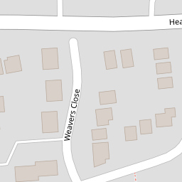


Leaflet © OpenStreetMap contributors
The heatmap indicates the level of crime in the area. The color of the heatmap indicates the crime severity and recency.
Metrics Year-on-Year
- Average area value
- 359,625.00 £Decreased by 23.81 %
- Average area rental value
- 1,583.00 £/moIncreased by 2.19 %
- Est rental Yield
- 5.28 %Increased by 34.01 %
- Crime Rate
- 29.00 %Unchanged by 0.00 %
from 472,010.00 £
from 1,549.00 £/mo
from 3.94 %
from 29.00 %
Nearby Schools
| Name | Type | Ofsted | Distance |
|---|---|---|---|
| Staplehurst School | Community School | Requires improvement | 0.74 KM |
| Frittenden Church Of England Primary School | Voluntary Controlled School | Good | 4.82 KM |
| Sissinghurst Voluntary Aided Church Of England Primary School | Voluntary Aided School | Good | 5.92 KM |
| Sutton Valence Primary School | Community School | Good | 6.71 KM |
| Headcorn Children'S Centre | Children's Centre | 6.85 KM |
Images
Nearby Streets
| Name | Average Price | Average Sqft | Distance |
|---|---|---|---|
| High Street | £ 492,824 | 0 | 0.00 KM |
| Nicholsons Walk | £ 0 | 0 | 0.00 KM |
| Sweetlands Lane | £ 0 | 0 | 0.00 KM |
| Lodge Road | £ 0 | 0 | 0.00 KM |
| Crouch Road | £ 300,000 | 0 | 0.00 KM |
Nearby Transport
| Name | NLC | TLC | Distance |
|---|---|---|---|
| Staplehurst | 5228 | SPU | 0.98 KM |
| Marden (Kent) | 5223 | MRN | 7.09 KM |
| Headcorn | 5220 | HCN | 7.85 KM |
Nearby Listings
| Address | Price | Type | Score | Distance |
|---|---|---|---|---|
| Slaney Road, Staplehurst, Kent | £ 460,000 | BUY | 7 / 10 | 0.06 KM |
| Slaney Road, Staplehurst, Tonbridge, Kent | £ 550,000 | BUY | 6 / 10 | 0.06 KM |
| Staplehurst, Kent | £ 359,950 | BUY | 7 / 10 | 0.07 KM |
| Poyntell Road, Staplehurst, Kent | £ 260,000 | BUY | 7 / 10 | 0.17 KM |
| Poyntell Road, Staplehurst, Kent | £ 172,000 | BUY | 7 / 10 | 0.17 KM |
Nearby Properties
| Address | Price | Distance |
|---|---|---|
| 2 Weavers Close | £ 279,995 | 0.00 KM |
| 6 Weavers Close | £ 245,000 | 0.01 KM |
| Furzefield | £ 770,000 | 0.04 KM |
| Staveleys | £ 240,000 | 0.04 KM |
| Turville | £ 225,000 | 0.04 KM |